---------------------------------------
Go At Turn Road/Description
---------------------------------------
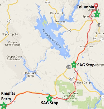
60.8 SAG Stop 4
Knights Ferry
0.2 61.0 S Covered Bridge Road
through gate and over bridge
0.3 61.3 S Shuper Road after Bridge
- begin uphill/rollers
0.3 61.6 L Sonora Rd
0.3 61.9 L Hwy 108/120
8.2 70.1 R Green Springs Rd
70.1 X SAG Stop 5 - on corner - 9.2 mi, 1077 ft
70.1 S Green Springs Rd
1.4 71.5 R La Grange Rd
1.7 73.2 L Red Hills Rd
2.7 75.9 L Sims Rd
1.3 77.2 X cross Hwy 120
77.2 S Sims Rd
1.0 78.2 L Hwy 49
2.1 80.3 X SAG Stop 6 - at Hwy 108 - 10.2 mi, 614 ft
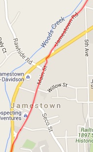
80.3 R Hwy 108/49
2.7 83.0 R Main St. - Jamestown - food and water
0.5 83.5 X cross Hwy 49/108
- do not get on Hwy 49
0.0 83.5 S Jamestown Rd.
3.9 87.4 L Shaws Flat Rd.
0.3 87.7 X cross Hwy 49
- do not get on Hwy 49
87.7 S Stay on Shaws Flat Rd.
0.8 88.5 S Springfield Rd.
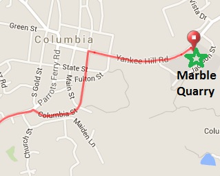
0.7 89.2 L Parrotts Ferry Rd / Broadway St.
0.4 89.6 R Columbia St. - Columbia
0.4 90.0 R Jackson St. - becomes Yankee Hill Rd
0.4 90.4 End SAG Stop 7 - 10.1 mi, 1120 ft
Marble Quarry Campground
- 4016 feet total
everybody in by 4:30
|
Day 2B - Knights Ferry to Columbia
(https://ridewithgps.com/routes/17503103)
EMERGENCY: 911 or CALL DONNY (408)386-1638

NEAREST HOSPITAL

SONORA REGIONAL MEDICAL CENTER
1000 GREENLEY ROAD
SONORA, CA
(209) 536-3437

NEAREST BIKE SHOP

JT CYCLES
55 WASHINGTON ST (HWY 49)
SONORA, CA
(209) 536-9882
|